|
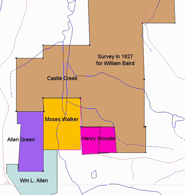
This recreation of the original survey shows several items. First, the William Baird survey overlays the 1803 General Jones survey nearly perfectly and that allows an accurate placement on the present day map. Second, the placement of the Moses Walker property is subject to error because the original corners did not match well with what the surveyor found. This can be seen by the dotted lines in the original survey. The error could be as great as about 100 yards north to south or 100 yards east to west. Other deeds of this same period however fix the Moses Walker property in this location based on known landmarks such as roads and creek branches. Third, the Henry Woodie property, which was originally Moses Walker property overlays what the surveyor considered to be William Bairds property. There is an approximately 40 acre error which is discussed in more detail later in this presentation. |
|
|